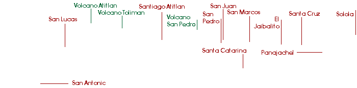
Map - Lake Atitlan, Guatemala
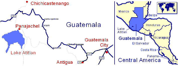
Guatemala is Central America's largest and most populous country. Most Guatemalans live in the temperate mountainous region called the Western Highlands.
 |
|
Note: For some reason known only to Google neither Panajachel or Antigua are visible in the interative map below without zooming in. You can however see them clearly in the map above. Click on the map to zoom in or right-click to zoom out. |
 |
The lake is about a two and a half hour drive from Guatemala City or Antigua. Most arrive at the lake in Panajachel and stay in a hotel there or take a boat to other hotels on the lake. Getting to Panajachel is easy. Travelers usually fly into Guatemala City and go directly to Antigua, where they spend a few days before coming to the lake. Transport services offer door-to-door service between Panajachel and Antigua, or anywhere else in Guatemala. The combination of being about 15 degrees above the equator and 1560 meters (5100 ft.) above sea level makes for an ideal climate. It's never uncomfortably cold or hot. The rainy season lasts from May to October, but the sun does shine some almost every day. Indeed for most of us who live here year round the rainy season is our favorite time of year. |
* Photo below was taken from this point overlooking the lake.
 |